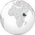
Ugasan:Ethiopia (Africa orthographic projection).svg

Size of this PNG preview of this SVG file: 550 × 550 piksel. Na asing angka resolusi: 240 × 240 piksel | 480 × 480 piksel | 768 × 768 piksel | 1,024 × 1,024 piksel | 2,048 × 2,048 piksel.
Ungkuran na tingkos (Berkas SVG, nominal 550 × 550 piksel, balga ni surat partadingan: 143 KB)
Jujur ni ugasan
Piltik di sada tanggal/pukul laho mangida ugasan on di tingki i.
| Tanggal/Pukul | Metmetna | Dimensi | Sipanghasea | Hata panambai | |
|---|---|---|---|---|---|
| saonari | 16:42, 30 Agustus 2012 |  | 550 × 550 (143 KB) | Sémhur | Same with shadow |
| 16:40, 30 Agustus 2012 |  | 550 × 550 (143 KB) | Sémhur | Correcting few mistakes | |
| 17:28, 15 Juli 2011 |  | 550 × 550 (134 KB) | Mixx321 | Sudan Południowy | |
| 18:34, 27 Desember 2009 |  | 550 × 550 (132 KB) | Sémhur | == {{int:filedesc}} == {{Information |Description={{en|1=Orthographic map of Africa, showing Ethiopia location.}} {{fr|1=Carte orthographique de l'Afrique, montrant l'emplacement de l'Éthiopie.}} |Source=*[[:File:Africa |
Parhaseangon ni ugasan
alaman pangait tu alualu on:
Parhaseangon ugasan na global
Wiki na asing manghaseanghon ugasan on:
- Parhaseangon di ady.wikipedia.org
- Parhaseangon di am.wikipedia.org
- Parhaseangon di am.wiktionary.org
- Parhaseangon di ang.wikipedia.org
- Parhaseangon di arc.wikipedia.org
- Parhaseangon di ar.wikipedia.org
- Parhaseangon di ar.wiktionary.org
- Parhaseangon di arz.wikipedia.org
- Parhaseangon di avk.wikipedia.org
- Parhaseangon di azb.wikipedia.org
- Parhaseangon di az.wiktionary.org
- Parhaseangon di ban.wikipedia.org
- Parhaseangon di be-tarask.wikipedia.org
- Parhaseangon di be.wikipedia.org
- Parhaseangon di bg.wikipedia.org
- Parhaseangon di bh.wikipedia.org
- Parhaseangon di bi.wikipedia.org
- Parhaseangon di bm.wikipedia.org
- Parhaseangon di bxr.wikipedia.org
- Parhaseangon di cdo.wikipedia.org
- Parhaseangon di ceb.wikipedia.org
- Parhaseangon di chr.wikipedia.org
- Parhaseangon di ckb.wikipedia.org
- Parhaseangon di cs.wikipedia.org
- Parhaseangon di cu.wikipedia.org
- Parhaseangon di dag.wikipedia.org
- Parhaseangon di da.wikipedia.org
- Parhaseangon di de.wikivoyage.org
- Parhaseangon di din.wikipedia.org
- Parhaseangon di el.wikipedia.org
- Parhaseangon di en.wikipedia.org
- Rastafari
- Ethiopia
- List of companies of Ethiopia
- LGBT rights in Ethiopia
- History of the Jews in Ethiopia
- List of conflicts in Ethiopia
- User:Pharaoh Amun
- Wikipedia talk:Manual of Style/Pronunciation/Archive 9
- User:PMK2000/sandbox/Ethiopia
- User:JosephMohan/sandbox
- Wikipedia:Wikipedia Signpost/2019-10-31/On the bright side
- Wikipedia:Wikipedia Signpost/Single/2019-10-31
- User:BushelCandle/Ethiopia - stable lede
- User:BushelCandle/Template:Ethiopia
- 2023 Ethiopian crackdown on the hospitality industry
- Portal:Ethiopia
- Portal:Ethiopia/Intro
- Parhaseangon di en.wikibooks.org
Ida lumobi godangan pamangke global sian ugasan on.
