
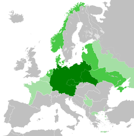
Ugasan:Greater German Reich (1942).svg

Size of this PNG preview of this SVG file: 450 × 456 piksel. Na asing angka resolusi: 237 × 240 piksel | 474 × 480 piksel | 758 × 768 piksel | 1,011 × 1,024 piksel | 2,021 × 2,048 piksel.
Ungkuran na tingkos (Berkas SVG, nominal 450 × 456 piksel, balga ni surat partadingan: 594 KB)


.svg)
.svg)
.svg)
.svg)
.svg)


.svg)
.svg)
.svg)


.png)
.png)


.svg)


.svg)

.svg)


.svg)
.svg)
.svg)
.svg)


.svg)
.png)


.svg)


.svg)
.svg)


.svg)


.svg)


.svg)
.svg)
.svg)
.svg)
.svg)
.svg)
.svg)
.svg)
_cropped.svg)
.svg)
.svg)
.svg)
.svg)
.svg)
.svg)
.svg)
.svg)
.svg)
.svg)
.svg)
.svg)
.svg)
.svg)
.svg)
.svg)
.svg)
.svg)
.svg)
.svg)
.svg)
.svg)
.svg)
.svg)
.svg)
.svg)
.svg)
.svg)
.svg)
.svg)
.svg)
.svg)
.svg)
.svg)
.svg)
.svg)
.svg)
.svg)
.svg)
.svg)
.svg)
.svg)
.svg)
.svg)
.svg)
Jujur ni ugasan
Piltik di sada tanggal/pukul laho mangida ugasan on di tingki i.
.svg&dir=prev)
.svg&offset=20180422235102)
.svg&offset=&limit=20)
.svg&offset=&limit=50)
.svg&offset=&limit=100)
.svg&offset=&limit=250)
.svg&offset=&limit=500)
| Tanggal/Pukul | Metmetna | Dimensi | Sipanghasea | Hata panambai | |
|---|---|---|---|---|---|
| saonari | 03:48, 21 Maret 2023 | | 450 × 456 (594 KB) | Qbox673 | Reverted to version as of 07:51, 23 August 2020 (UTC) Please establish consensus on the talk page before changing. |
| 02:16, 20 Maret 2023 |  | 450 × 456 (1.51 MB) | Daniilnihuya | Reverted to version as of 18:47, 22 August 2020 (UTC) | |
| 14:51, 23 Agustus 2020 |  | 450 × 456 (594 KB) | BOS2077 | Reverted to version as of 13:23, 28 July 2020 (UTC) | |
| 01:47, 23 Agustus 2020 |  | 450 × 456 (1.51 MB) | Terryfirut | Reverted to version as of 17:17, 5 July 2020 (UTC) | |
| 20:23, 28 Juli 2020 |  | 450 × 456 (594 KB) | Staberinde | Reverted to version as of 01:04, 24 April 2018 (UTC) restore old version, puppet states are not the same thing as occupied territory | |
| 11:12, 7 Juli 2020 |  | 450 × 456 (1.04 MB) | Croatianpotato | Reverted to version as of 22:35, 4 July 2020 (UTC) | |
| 00:17, 6 Juli 2020 |  | 450 × 456 (1.51 MB) | Hell - lllio | Winter Offensive Occupied Territory | |
| 05:35, 5 Juli 2020 |  | 450 × 456 (1.04 MB) | Hell - lllio | Vichy France (and its colonies) and Slovakia we're German Puppet States, so it should be Included in the Civilian Controlled Occupied Territories (Puppets) | |
| 08:04, 24 April 2018 |  | 450 × 456 (594 KB) | TRAJAN 117 | +++ | |
| 06:51, 23 April 2018 |  | 450 × 456 (594 KB) | TRAJAN 117 | +++ |
Parhaseangon ni ugasan
alaman pangait tu alualu on:
Parhaseangon ugasan na global
Wiki na asing manghaseanghon ugasan on:
- Parhaseangon di ar.wikipedia.org
- Parhaseangon di av.wikipedia.org
- Parhaseangon di az.wikipedia.org
- Parhaseangon di bg.wikipedia.org
- Parhaseangon di cs.wikipedia.org
- Parhaseangon di el.wikipedia.org
- Parhaseangon di en.wikipedia.org
- Parhaseangon di es.wikipedia.org
- Parhaseangon di fr.wikipedia.org
- Parhaseangon di gn.wikipedia.org
- Parhaseangon di he.wikipedia.org
- Parhaseangon di hr.wikipedia.org
- Parhaseangon di hu.wikipedia.org
- Parhaseangon di id.wikipedia.org
- Jerman Nazi
- Daftar imperium terbesar
- Anschluss
- Wikipedia:Artikel pilihan/Jadwal/Usulan/2020
- Wikipedia:Artikel pilihan/Jadwal/Usulan/2020/Periode 3
- Wikipedia:Artikel pilihan/Jadwal/Usulan/2020/Periode 8
- Wikipedia:Artikel pilihan/Daftar artikel pilihan 2020
- Wikipedia:Artikel Pilihan/32 2020
- Wikipedia:Arsip halaman utama/2020/08/03
- Wikipedia:Arsip halaman utama/2020/08/04
- Wikipedia:Arsip halaman utama/2020/08/05
- Wikipedia:Arsip halaman utama/2020/08/06
- Wikipedia:Arsip halaman utama/2020/08/07
- Wikipedia:Arsip halaman utama/2020/08/08
- Wikipedia:Arsip halaman utama/2020/08/09
- Wikipedia:Artikel pilihan/Daftar artikel pilihan 2023
- Wikipedia:Artikel pilihan/Jadwal/Usulan/2023
- Wikipedia:Artikel pilihan/Jadwal/Usulan/2023/Periode 2
Ida lumobi godangan pamangke global sian ugasan on.
.svg)
.svg)